Verified: updated on

China Surveying and Mapping Geospatial Information Technology Equipment Exhibition
CHINTERGEO
- Dates
- Show Hours:
- Highlights
- The largest professional trade show for the surveying mapping and geospatial information industries in the Asia-Pacific region.

Exhibition Data
- 1/1
- Edition
- 22000㎡
- Exhibition area
- 300
- Exhibitors
- 15000
- Visitors
Changsha Survey Expo Details
- Industry:
- Survey fairChangshaSurvey Expo
- Organizer:
- CHINTERGEO Alliance
- Venue:
- Address:
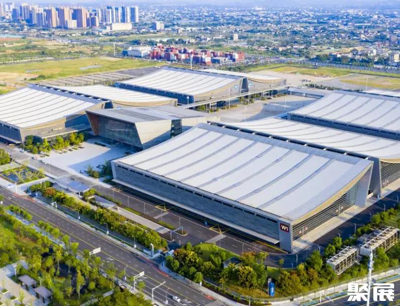
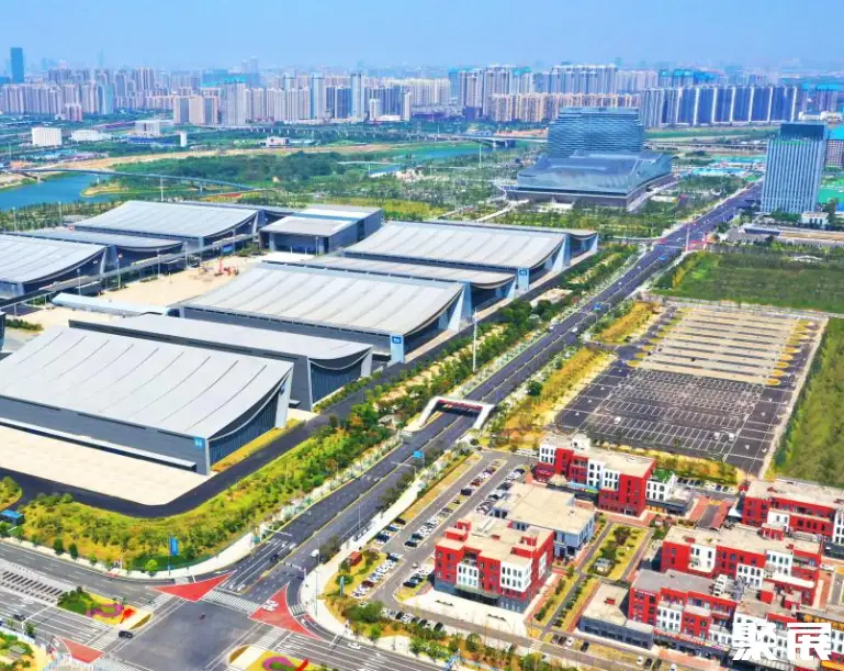
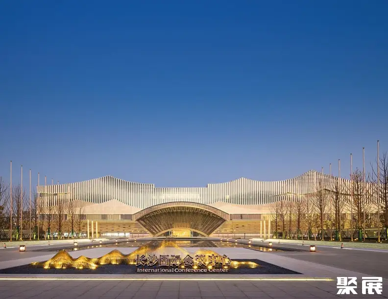
- No. 118, Guo Zhan Road, Changsha County, Changsha City, Hunan Province
Profile
The China International Exhibition on Surveying, Mapping and Geoinformation Technology Equipment (CHINTERGEO), is organized by the CHINTERGEO Consortium.It aims to establish a forum platform that places enterprises at its core and is market‑oriented. The forum brings together renowned experts, scholars, and business leaders from both domestic and international arenas to discuss industry‑wide strategies and cutting‑edge technologies, anticipate future trends, and explore new avenues for corporate growth.
As the surveying, mapping, and geoinformation equipment sector continues to advance rapidly with constant product innovation, the exhibition remains true to its original mission of “serving the industry and serving enterprises.” Guided by the principle of “market‑driven operations and respect for market dynamics,” it has meticulously built and maintained a robust platform for industry dialogue, actively fostering technological exchange, product promotion, information sharing, and business development—making significant contributions to the sector’s growth. Over the years, the China International Exhibition on Surveying, Mapping and Geoinformation Technology Equipment (CHINTERGEO), as the largest specialized trade show for the surveying and geoinformation industry in the Asia‑Pacific region, has firmly established its reputation among industry professionals. Copyright of this content belongs to Juzhan; unauthorized reproduction is prohibited.
The China International Exhibition on Surveying, Mapping and Geoinformation Technology Equipment (CHINTERGEO)brings together leading companies in the surveying and geoinformation sector, showcasing advanced products and state‑of‑the‑art technologies developed in China, while also highlighting numerous small and medium‑sized enterprises. In addition to cutting‑edge surveying equipment such as drones and LiDAR systems, the exhibition features a comprehensive range of complementary accessories and ancillary devices, seamlessly connecting the upstream and downstream segments of the industry’s value chain and providing a centralized platform for the sector to present its full spectrum of offerings.
The China International Exhibition on Surveying, Mapping and Geoinformation Technology Equipment (CHINTERGEO), steadfastly upholding its commitment to “serve the industry and serve enterprises,” continues to play a vital role in shaping the future of China’s surveying and geoinformation sector.
China Surveying and Mapping Geospatial Information Technology Equipment Exhibition tickets are e-tickets. Mainland China visitors must complete online pre-registration with real-name ID verification; overseas visitors must use passport verification; Hong Kong, Macao, and Taiwan visitors must use their travel permit. On site, verify entry with your ID card or by scanning the e-ticket QR code.
Partial exhibitor directory and exhibitor list for China Surveying and Mapping Geospatial Information Technology Equipment Exhibition: 武汉煜炜光学科技有限公司, 陕西艾瑞科惯性技术有限公司, 凌云光技术股份有限公司, 深圳市施罗德工业集团有限公司, 上海华测导航技术股份有限公司, 上海司南导航技术股份有限公司, and others. The 2026 edition is expected to feature 500+ exhibiting companies. To obtain the full exhibitor directory (including booth numbers and contact details), please visit the official exhibition website or contact Jufair.
The Exhibition Value of the China International Surveying, Mapping and Geoinformation Exhibition (CHINTERGEO)
- China’s Annual Flagship Event in the Surveying, Mapping and Geoinformation Equipment Sector: Since its inception in 1996, this annual exhibition has become one of the most influential professional events in China and globally within the surveying, mapping, and geoinformation equipment industry. The 2025 edition, themed “Integrating Innovation, Expanding Boundaries, and Co‑Creating a New Chapter in Geoinformatics,” brings together the entire industry chain to showcase cutting-edge technologies, push the frontiers of application, and deepen international cooperation, injecting fresh momentum into high‑quality industrial development.
- Comprehensive Coverage Across Five Major Thematic Zones of the Entire Industry Chain: The exhibition features five specialized zones—Smart Equipment and High‑End Sensors; Real‑World 3D and Digital Twin Technologies; Geospatial Information Security and Independent Controllability; Integrated Air‑Space‑Land‑Sea Monitoring; and Geoinformation + Industry Application Solutions. From BeiDou high‑precision positioning devices, LiDAR‑equipped drones, and underwater exploration robots to surveying robots, real‑world 3D modeling platforms, and digital twin systems, the show presents a complete portfolio of next‑generation data‑collection equipment characterized by high precision, intelligence, and miniaturization, along with end‑to‑end solutions spanning the entire value chain.
- A Global Hub for Buyer Resources: The 2025 event will attract nearly 300 overseas professional buyers from more than 30 countries and regions, including government agencies, major engineering contractors, utility companies, and international distributors—key decision‑makers driving procurement. With an exhibition space of nearly 20,000 square meters, the event is expected to welcome over 30,000 professional visitors, among whom the presence of international buyers underscores China’s growing international competitiveness and market appeal in surveying, mapping, and geoinformation technology and equipment.
- Leading Enterprises Compete on One Stage, with Domestic Players Rising Strongly: The exhibition gathers nearly 200 renowned industry brands, including South Surveying, CHC Navigation, Hi-Target, Huace Navigation, and Sinan Navigation. South Surveying has designed the largest booth at the show, organizing seven thematic zones to highlight hundreds of core products and demonstrate its comprehensive industrial strength. Huace Navigation presents its all‑round “Sky‑Ground‑Water‑Engineering” smart equipment system, covering surveying, intelligent 3D solutions, marine mapping, positioning services, and safety monitoring. Meanwhile, CHC Navigation unveils its new iBoat BSC unmanned boat multi‑beam measurement system, whose multi‑frequency intelligent ADCP has been included in the Ministry of Water Resources’ catalog of promoted advanced technologies.
- Innovative Breakthroughs in Cutting‑Edge Technology Applications: The boundaries of geoinformation applications are rapidly expanding, with the exhibition highlighting innovative practices in critical national strategies such as emergency management, urban safety, underwater exploration, smart cities, and rural revitalization. Nanjing Zhihui Space’s unmanned marine exploration vessel can perform seabed topography and water quality surveys, significantly reducing labor costs and operational expenses. Nanjing Yuefei Intelligence showcases an oil‑and‑gas laser methane inspection drone that employs tunable semiconductor laser absorption spectroscopy to enable long‑range, non‑contact gas leak detection. Additionally, Nanjing Kaitianyan’s “Flying Lifebuoy” drone can precisely deliver a lifebuoy to a drowning victim within a 1‑kilometer radius at a speed of 12 meters per second, providing rapid aerial rescue assistance.
- Authoritative Empowerment Through High‑Level Forums: During the exhibition, numerous high‑caliber technical forums will be held, addressing hot topics such as the development of surveying, mapping, and geoinformation technology and equipment applications; innovations in emergency surveying and intelligent monitoring of urban infrastructure; advances and applications in aquatic surveying; the growth of the low‑altitude economy; and the integration of digital technologies in transportation. Renowned academicians, leading scholars, and industry leaders will share their insights, offering forward‑looking strategic guidance to attendees.
- A Platform for Deep Integration of Industry, Academia, Research, and Application: The event invites Chinese Academy of Engineering academicians Guo Renzhong, Yue Qingrui, and other distinguished experts to jointly explore deeper integration and innovative applications of surveying, mapping, and geoinformation technologies across broader fields. Onsite demonstrations of core technological achievements—including drone‑based surveying, 3D laser scanning, and geographic information systems—will establish a platform for exchange among R&D, manufacturing, distribution, and end‑users, fostering the adoption and dissemination of new technologies, equipment, and services.
- International Cooperation and Industry Integrity Building: Throughout the exhibition, classic activities such as closed‑door co‑creation sessions for distributors and the selection and award ceremony for the Top 100 Honest Distributors will be held, promoting a new ethos of “integrity as the foundation, trust as the driver” within the industry. With professional buyers from over 30 countries and regions in attendance, the event successfully establishes a high‑quality platform for international technical exchanges, commercial collaborations, and industrial matchmaking, further highlighting the growing international competitiveness of China’s surveying, mapping, and geoinformation technologies and equipment.
Range
- Integrated Surveying and High-Precision Positioning Brands: South Surveying, Guangzhou Zhonghaida, Shanghai Huace Navigation, Beijing Hezhong Sizhuang, Shanghai Sinan Navigation, Suzhou Yiguang Instruments, Topcon Sokkia, Zhongwei Surveying, Tianshuo Navigation, Alpha Surveying, Guangzhou Situoli, Shanghai Zheyuan Navigation, Zhendian Technology, Hexin Xingtong, Qianxun Location
- LiDAR and 3D Scanning Brands: Beijing Digital Lvtu, Angrui Information Technology, Ruisu Information, Qiyu Innovation, Wuhan Jishang Navigation, Shenzhen Qiyu Innovation, Ousilai, Wuhan Yuwei Optics, Wuhan Xiangyin Technology, Shenzhen Sail Intelligent Control, Beijing Fustede, Shenzhen Liuxing Technology, Suzhou Futian Laser, Ru Ni Suoshi (Beijing)
- UAV and Unmanned Vessel Brands: DJI, WoFei Changkong, Puzhou Aircraft, Fengjiang Intelligence, Nanjing Kaitianyan UAV, Nanjing Zhihui Space, Shenzhen Feima Robotics, Chengdu Zongheng Automation, Shenzhen Keweitai, Yunsheng Intelligence, Hangtian Shuwei, Beijing Yuxiang Intelligent Control, Zhonghaida Marine (iBoat Unmanned Vessel), Haizhuo Tongchuang, Shanghai Jingdao Scientific Instruments
- Inspection, Monitoring, and Smart Security Brands: Wuhan Hanning Rail Transit, Jianyan (Shanghai) Information Technology, Beijing Laidataike, Wuhan Yanshi Technology, Beijing Shenzhou Huace, Jinan Langrui Testing Technology, Tianjin Saite Testing Machines, Beijing Zhongdi Yuanda, Beijing Gaotie Jian Technology, Nanjing Shuixin Technology, Wuhan Zhijue Space
- Core Components and Optoelectronic Technology Brands: Shanghai Jiaguang Optics, Suzhou Futian Laser, Shenzhen Moke Lian, Beiwai Beehive IoT, Hexin Xingtong, Shanghai Mido Measurement & Control, Tianjin Weisman Optics, Beijing Bofeitongli, Changzhou Maituo Optoelectronics, Suzhou Industrial Park Dexin Precision Instruments, Tianjin Dingbo Precision Instruments, Wuhan Mengxin Technology, Nanjing Donglai Optics, Shenda Wei Technology, Shanghai Haiji Information Technology
- Innovative Technologies and System Integration Brands: Zhongqu Technology, Zhendian Technology, Tianhui Electrical, Shanghai Lianshi Navigation, Wuhan Tianji Hang, Shanghai Huace Chuangshi Measurement & Control, Nanjing Kaitianyan UAV, Shanghai Shikong Qidian, Wuhan Ruisu Information, Nanjing Shuixin Technology, Shanghai Jingdao Scientific Instruments, Beijing Xingtian Technology
Review
The 2025 China Surveying and Mapping Geographic Information Technology Equipment Exhibition was successfully held from December 4 to 6 at the Nanjing International Exhibition Center. With the theme “Integration, Innovation, Expanding Boundaries, and Co‑Creating a New Chapter in Geographic Information,” the event spanned nearly 20,000 square meters, bringing together nearly 200 renowned industry brands, including South Surveying, CHC Navigation, Hi-Target, Huace Navigation, Sinan Navigation, Alpha Mapping, and others. Among them, more than 40 leading geographic information enterprises from Jiangsu Province participated. Over the three-day exhibition, professional visitors exceeded 30,000, and nearly 300 overseas buyers from over 30 countries and regions attended, representing government agencies, major engineering contractors, utility companies, and international distributors.
Key Highlights from Industry LeadersSouth Surveying showcased seven thematic zones across the largest booth at the show, presenting hundreds of core products. While demonstrating its cutting-edge technological prowess, the company also offered an immersive visitor experience through live virtual tours, on-site roadshows, and interactive prize draws. The company’s founder and chairman, Ma Chao, was invited to address the 2025 Symposium on the Development of Surveying and Mapping Geographic Information Technology Equipment Applications, where he delivered a keynote speech titled “The Localization Process of Surveying Equipment and Its Future Prospects.” On the eve of the exhibition, South Surveying hosted a partner appreciation gala and an AI RTK product launch event, officially unveiling its new line of AI‑powered RTK devices, which can be activated via voice commands simply by saying “Xiao Nan, Xiao Nan.”
CHC Navigation introduced its latest iBoat BSC unmanned boat equipped with a multi‑beam echo sounder system. Its multi‑frequency intelligent ADCP has been included in the Ministry of Water Resources’ Catalogue of Promoted Advanced Technologies and is already deployed at over one hundred hydrological stations nationwide. Hi‑Target presented three groundbreaking new products, including the S30/G30 laser‑dual‑camera RTK, filling critical gaps in traditional surveying equipment for complex operational scenarios. Meanwhile, Sinan Navigation highlighted its fourth‑generation Beidou high‑precision positioning chip QC7820, K9 series modules, and a next‑generation compact laser‑dual‑camera RTK total station, underscoring its comprehensive R&D portfolio spanning core components to complete systems.
Nanjing Companies Showcase Cutting‑Edge InnovationsNanjing Zhihui Space Technology Co., Ltd. exhibited an autonomous marine exploration vessel capable of mounting multi‑beam sonar equipment to conduct seabed topographic mapping and water quality monitoring, significantly reducing labor and operational costs. Nanjing Yuefei Intelligent Technology Co., Ltd. unveiled a TDLAS‑based oil and gas methane detection drone that identifies unique laser absorption fingerprints of methane molecules, enabling long‑range, non‑contact leak detection. Additionally, Nanjing Kaitianyan Drone Technology Co., Ltd. showcased a 4.5‑kilogram “flying lifebuoy” capable of reaching a drowning victim within one kilometer at a speed of 12 meters per second, delivering rapid rescue assistance from the air.
High‑Level Forums and Industry ExchangesOn December 5, four specialized forums were held concurrently: the 2025 Symposium on the Development of Surveying and Mapping Geographic Information Technology Equipment Applications; the 2025 Conference on Technological Innovation and Application in Aquatic Resource Surveying; the 2025 Conference on Technological Innovation and Application in Emergency Surveying and Smart Urban Infrastructure Monitoring; and the 2025 Closed‑Door Forum for Co‑Creation among Distributors in the Surveying and Mapping Geographic Information Industry. The events brought together prominent experts, including Chinese Academy of Engineering academicians Guo Renzhong and Yue Qingrui, to explore deeper integration and innovative applications of surveying and mapping technologies across broader domains. During the exhibition, the “2024 Honest Distributor” awards ceremony was also held, with nearly 70 winning entities receiving bronze plaques, thereby reinforcing the industry’s ethos of integrity and trustworthiness. The next edition of the exhibition is scheduled to take place in Changsha in 2026.
CHINTERGEO Exhibitior List
China Surveying and Mapping Geospatial Information Technology Equipment Exhibition Range
- Intelligent Transportation Solutions ,
- Underground Utility Tunnel Planning, Design and Management Solutions ,
- Smart Digital Landscape Solutions ,
- Commercial Real Estate Project Space Planning and Management Solutions ,
- Deformation Monitoring System Solutions ,
- Satellite Remote Sensing Image Data Acquisition, Processing, and Service Solutions
- Surveying and Mapping Satellites ,
- High- and Medium-Altitude Aerial Photogrammetry Aircraft ,
- Low-Altitude Surveying Drones ,
- Surveying Unmanned Surface Vessels ,
- Mobile Mapping Vehicles ,
- Surveying Robots ,
- Laser 3D Scanners ,
- Airborne LiDAR ,
- Photogrammetric Cameras
- RTK ,
- Total Stations ,
- Electronic Theodolites ,
- Electronic Levels ,
- Optical Theodolites ,
- Optical Levels ,
- Laser Plumb Bobs ,
- Leveling Instruments ,
- Plumb Spheres ,
- Land Measuring Devices ,
- Laser Rangefinders ,
- Ranging Telescopes ,
- GPS Navigation Devices ,
- GIS Handheld Terminals ,
- Measuring Tools ,
- Drawing Plotters ,
- Geological Compasses ,
- Rebound Testers
- Spirit Levels ,
- Staffs ,
- Target Poles ,
- Data Cables ,
- Specialized Batteries ,
- Screws for Surveying Instruments ,
- Optical Lenses and Components ,
- Tripods ,
- Explosion-Proof Cases ,
- Testing and Maintenance Equipment
Booth Sales

Ms. ZengGold-Medal PM
3 Years Booth Sales
2026 Changsha Survey Ticket Sales

Mr. HanGold-Medal PM
3 Years Booth Sales
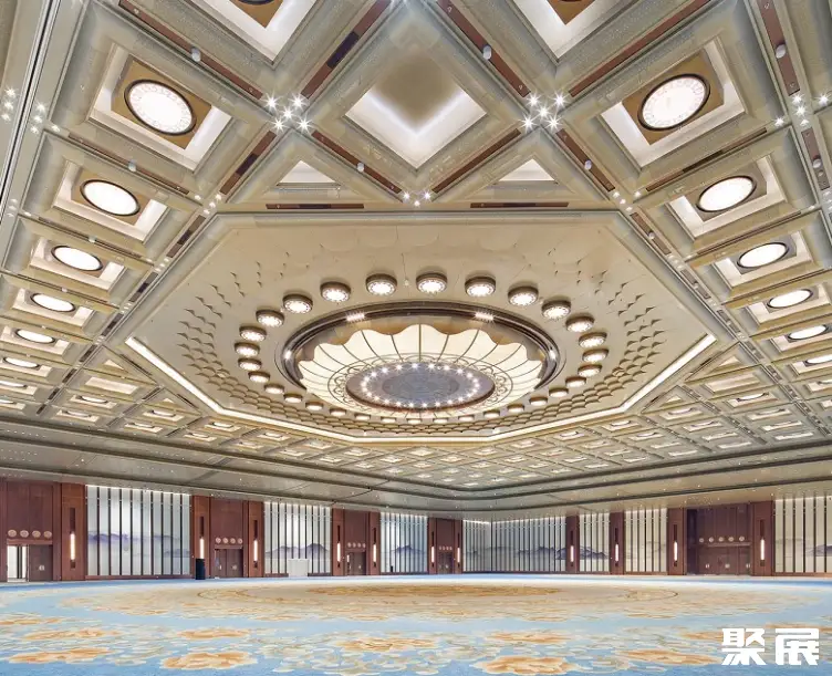
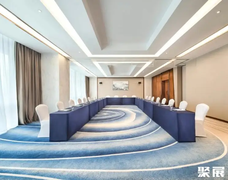
Changsha Survey Venue

Changsha Survey Booth Price
Process
- 1.Submit the business license of the company
- 2.Submit product picture and name
- 3.Receive exhibition presentation documents and booth drawings
- 4.Submit booth application form/Sign booth contract
- 5.Pay the contract booth deposit
- 6.Prepare for exhibition