Geo Week (Salt Lake City, USA)Geo Week
Geo Week (Salt Lake City, USA) Profile
Geo Week is the most authoritative geospatial and surveying exhibition in North America. It operates as a collaborative multi-event platform featuring several geospatial conferences, including the International Lidar Mapping Forum (ILMF), the ASPRS Annual Conference, and the MAPPS Federal Programs Conference. Each event features its own dedicated conference program, all integrated within a single exhibition hall and inclusive networking events.
The previous edition of Geo Week covered an exhibition area of 18,000 square meters, hosting 375 exhibitors from China, Germany, Dubai, Turkey, Mexico, Russia, and other regions, with 13,149 attendees. It is a premier technical conference and exhibition showcasing the latest airborne, terrestrial, and underwater LiDAR, as well as emerging remote sensing and data collection tools and technologies. With a strong emphasis on data acquisition, fusion, integration, processing, and visualization, it is a must-attend event for professionals in utility asset management, transportation, urban modeling, coastal mapping, and related fields.
The primary audience consists of professional visitors from government agencies and specialized industry vendors with procurement intentions. This exhibition is strictly open to trade professionals only. The exhibition's mission is to advance knowledge and deepen the understanding of surveying science to promote the responsible application of photogrammetry, remote sensing, Geographic Information Systems (GIS), and supporting technologies.
Juzhan has successfully organized numerous high-quality enterprises to participate in this event multiple times! Geo Week provides an excellent networking and exchange platform for industry experts in geodesy, geographic information, and land management.
Exhibitor List
Geo Week (Salt Lake City, USA) Product Range
Geographic Information Solutions: Intelligent transportation solutions, underground utility tunnel planning, design, and management solutions, smart digital landscaping solutions, commercial real estate spatial planning and management solutions, deformation monitoring system solutions, satellite remote sensing image data acquisition, processing, and service solutions, etc.
High-Tech Surveying & Geographic Information Equipment: Surveying application satellites, medium/high-altitude aerial photography aircraft, low-altitude surveying UAVs, surveying USVs, mobile mapping vehicles & robots, 3D laser scanners, airborne LiDAR, photogrammetric cameras, etc.
Traditional Surveying Equipment: RTK systems, total stations, electronic theodolites, digital levels, optical theodolites, optical levels, laser pointers, rotary lasers, optical plummets, area measuring instruments, laser distance meters, rangefinder binoculars, GPS navigators, GIS handheld devices, measuring tapes/rulers, plotters, geological compasses, rebound hammers, etc.
Equipment Accessories & Components: Circular levels, leveling rods, ranging poles, data cables, specialized batteries, surveying instrument screws, optical lenses & components, tripods, protective transport cases, maintenance & testing equipment, etc. (Copyright of this content belongs to Juzhan. Unauthorized reproduction is prohibited.)
Geo Week (Salt Lake City, USA) Booth Sales


Geo Week (Salt Lake City, USA) Ticket Sales


Geo Week (Salt Lake City, USA) Venue
Geo Week (Salt Lake City, USA) Booth price

Standard booth Configuration
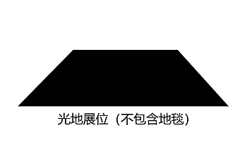
Blank booth Configuration
Geo Week (Salt Lake City, USA) Process
1.Submit the business license of the company
2.Submit product picture and name
3.Receive exhibition presentation documents and booth drawings
4.Submit booth application form/Sign booth contract
5.Pay the contract booth deposit
6.Prepare for exhibition
Survey Fair


 Online
Booth: 0571-88535771
Spectator: 0571-89099107

Online
门票咨询
Mr. Han
金牌项目经理
OnlineTel 13336023729
Mobile phone 15397162655
展位咨询
Ms. Zeng
金牌项目经理
OnlineTel 0571-86373771
Mobile phone 13083905827
Work time:Monday to Friday09:00-18:00
 My
My Ticket
- Booth apply