INTERGEO (Munich) - International Trade Fair for Mobile Mapping, UAVs, and Spatial DataINTERGEO
INTERGEO (Munich) - International Trade Fair for Mobile Mapping, UAVs, and Spatial Data Profile
INTERGEO (Munich) - International Trade Fair for Mobile Mapping, UAVs, and Spatial Data is the world's largest exhibition for the surveying and mapping industry. Organized by the German Society for Surveying, Geoinformation and Land Management (DVW), INTERGEO is an authoritative event in the global surveying sector, providing an excellent platform for experts in geodesy, geoinformation, and land management to exchange ideas.
This edition attracted over 18,500 professional visitors from nearly 120 countries and 530 exhibitors. Covering everything from artificial intelligence to digital twins, and from unmanned systems to geospatial big data, it has become the core hub for innovation in the global geospatial industry.
At INTERGEO, the geospatial industry is no longer just passively recording the world, but actively shaping the future. As Olaf Freier, Managing Director of HINTE Exhibition & Conference GmbH, stated: "This is not just about showcasing trends; it marks a new starting point—moving towards a sustainable, intelligent, and interconnected future for our planet."
This leading international trade fair for surveying, geoinformation, and land management attracts the international geospatial community and various application fields of geodata-based solutions. INTERGEO (Munich) has once again proven itself as the premier international conference platform for all aspects of geodesy, geoinformation, and land management.
JZhan has successfully organized numerous high-quality enterprises to participate! As a market leader, INTERGEO brings the geospatial community together and connects it with industry users.
Exhibitor List
INTERGEO (Munich) - International Trade Fair for Mobile Mapping, UAVs, and Spatial Data Product Range
Geodesy, Geographic Information Systems (GIS), geospatial data, cartography, photogrammetry, geology, UAVs and accessories, CAD, GPS, GIS, geospatial technologies, smart city-related technologies, hardware and software products for remote sensing and photogrammetry, surveying instruments and related accessories, etc. (Copyright belongs to JZhan. Reproduction without permission is prohibited.)
INTERGEO (Munich) - International Trade Fair for Mobile Mapping, UAVs, and Spatial Data Booth Sales


INTERGEO (Munich) - International Trade Fair for Mobile Mapping, UAVs, and Spatial Data Ticket Sales


INTERGEO (Munich) - International Trade Fair for Mobile Mapping, UAVs, and Spatial Data Venue
INTERGEO (Munich) - International Trade Fair for Mobile Mapping, UAVs, and Spatial Data Booth price

Standard booth Configuration
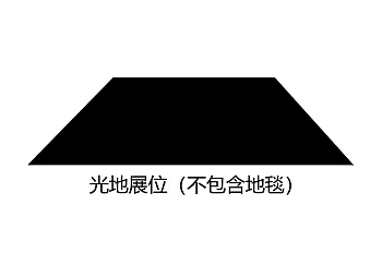
Blank booth Configuration
INTERGEO (Munich) - International Trade Fair for Mobile Mapping, UAVs, and Spatial Data Process
1.Submit the business license of the company
2.Submit product picture and name
3.Receive exhibition presentation documents and booth drawings
4.Submit booth application form/Sign booth contract
5.Pay the contract booth deposit
6.Prepare for exhibition
Survey Fair


 Online
Booth: 0571-88535771
Spectator: 0571-89099107

Online
门票咨询
Mr. Han
金牌项目经理
OnlineTel 13336023729
Mobile phone 15397162655
门票咨询
铜牌项目经理
OnlineTel 18067909721
Mobile phone 18067909721
展位咨询

Ms. Li
金牌项目经理
OnlineTel 18268116412
Mobile phone 18268116412
展位咨询

Ms. Liu
金牌项目经理
OnlineTel 18368120737
Mobile phone 18368120737
展位咨询
Ms. Zeng
金牌项目经理
OnlineTel 0571-86373771
Mobile phone 13083905827
Work time:Monday to Friday09:00-18:00
 My
My Ticket
- Booth apply